Sunday 27 November 2011

the 1609 Crown Survey and Map

One of the most important sources to the Landscape Archaeologist investigating the landscape of Medieval Sherwood Forest is the 1609 crown survey and map by Richard Bankes.

Picture: Excerpt from the 1609 crown survey map

This survey was commissioned for the newly crowned James I, and undertaken by the surveyor Richard Bankes in, or just before 1609.

It consists of a written survey of all the freehold land within the forest, and an accompanying map.

The map for the southern section of Sherwood Forest- known as 'Thorneywood' survives- unfortunately the maps for the 'High Forest' to the north and that for the area known as 'Rumwood' are now lost.

It is the earliest cartographically accurate depiction of the landscape of the forest, and unlike the earlier 'Belvoir map' depicts fields, roads, villages and rivers in a manner familiar to the modern reader. 

It also lists all the occupiers of land within the forest boundary (these people will be listed in various entries to come soon).

The map and survey are of huge importance for understanding the landscape and administration of the forest at the end of the medieval period- they catch a snap-shot of the landscape at a time when royal influence was beginning to dwindle, as powerful landlords came to dominate the area in the 17th century.

The Civil War of 1642-51 would dramatically alter the power structure of the forest.

It would also see vast areas of woodland cut down to fuel the war effort, and due to the collapse of Forest Administration at that time.

The dissolution of the monasteries in the 16th century had altered land ownership with many powerful magnates occupying land previously in Monastic hands.

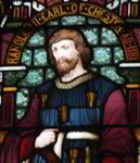
This process would mature in the 17th century, where men like the Earl of Newcastle took over the great royal manor of Mansfield and many of the royal centres in the forest. 

He would become both Keeper of Sherwood Forest and Justice in Eyre for the Forests North of the Trent at the same time. As well as the major landholder in the 'High Forest'.

So this map and survey is significant as it gives us a window into the forest as it was before these major changes.

It is also useful as a stepping-stone back to far older times- and combined with historic documents and other sources has formed the background of the Map of medieval Sherwood Forest created by Alan McCormick and myself with Nottinghamshire County Council.


In many other parts of the country 15th and 16th century enclosure of the great open fields altered the landscape- masking to an extent the earlier shape of things. 

This was recorded in a survey from the 16th century known as the Domesday of Enclosures for Nottinghamshire (this will be discussed in an entry soon).

The Forest Law seems to have lessened the impact of these enclosures on Sherwood Forest than in other areas.

This means that the 1609 survey offers a better view than would be the case for a non-forest area.

The 1609 crown survey then, offers a fantastic view of the late Medieval landscape.

It also offers a chance for Landscape Archaeologists and Historians to rebuild the Earlier landscape of Medieval Sherwood Forest.

The creation of the medieval landscape is vital, as it forms the backdrop for any serious study of the medieval Forest- giving us a landscape to populate with the characters and events of the time.

More to come soon on the uses of the map- and some of the features it depicts)

The maps were redrawn by Peter Burgess, and the survey was edited by Steph Mastoris and Sue Groves in 1998 for the Thoroton Society (see bibliography).

For more info see the link below:


Wednesday 23 November 2011

the Case of William Robehod


The oldest literary reference to Robin Hood comes from the medieval poem Piers Plowman by William Langland and dates from the year 1377.

However the use of the surname ‘Robinhood’ predates this considerably.


From the early 1980's onwards a number of ‘Robinhood’ surnames have been found in 13th century documents.

All of those found so far date from 1261-1290. This is a hundred years earlier than the Piers Plowman reference. 

This suggests that the legend- or the term ‘Robin Hood’ was in use by the second half of the 13th century at least. 

Any original Robin Hood must therefore have been operating before or around this time.

The notorious Folville gang operated in the early 14th century and were mentioned in Piers Plowman within a few years of their exploits (see outlaws page for more information).

Most of the surnames recorded are to do with law-breaking, and were suspected or outlawed criminals, as shown by the list below from the 1989 edition of J C Holt’s Robin Hood:

Alexander Robehod was sought for theft in Essex in 1272;

Gilbert Robehod was released to pledges by the justices after an unspecified charge in Suffolk in 1286;

Robert Robehod was indicted in Hampshire in 1294 on a charge of stealing sheep;

John Rabunhod was charged with others in 1272 with murder- after a quarrelsome brawl in a tavern near Fareham, Hampshire; he had fled and was outlawed.

And a William Robehod who appeared in 1261-2 in Berkshire as a member of an outlaw gang suspected of robberies and of harbouring robbers.

Coincidentally, along with these ‘Robin Hoods’ in a 1292 a Little John and a Petit Johan were both appealed of robbery.

(Holt 1989)

Of all these surnames the most significant is William Robehod of 1261.

His entry into history was discovered by David Crook formerly of the National Archives and former editor of the Transactions of the Thoroton Society.


William Robehod is listed for the crime stated above in the King's Rememberancer's Memoranda Roll of Easter 1262.

By a chance survival the crime is also recorded in the roll of the Justices in Eyre for Berkshire in 1261. 


Here William Robehod is actually revealled to be a William son of Robert le Fevere.


The Clerk in the 1262 roll had changed his name to Robehod!!!

Therefore the name in this instance is a nickname and not a surname. (Crook 1987).

Was Robin Hood a nickname for any 'Robbing Hoody'? 


Or was this clerk familiar with a legend already widely in circulation in 1261?


Whatever the reason the entry is incredibly significant as it means it would be very difficult if not impossible to be sure of the authenticity of any earlier ‘Robinhood’.

There are earlier names that could be the original Robin hood.

A 1225 entry for a Robert Hod on the Pipe Roll, with the form Hobbehod used in 1226 exists, and will be the subject of a future entry. 

But it could well be that the fame of Robin Hood may also be the insurance of his permanent obscurity (Holt 1989).

If anyone convicted of a crime, or outlawed in medieval England could potentially receive the nickname of a 'Robinhood' then maybe we can never be sure of the authenticity of anyone no matter how strong the case…

(More on Robert Hod or Hobbehod of 1225/6 coming soon, along with many other outlaws and their stories)


Monday 21 November 2011

the Fishpool Hoard

In 1966 the largest ever hoard of medieval gold coins was unearthed in the middle of Sherwood Forest.

This collection of 1,237 coins, four rings, four peices of jewllery, and two lengths of chain (Cherry 1973) dates from the reign of Edward IV (1460-83).

Picture: The Fishpool Hoard at the British Museum
It was deposited between winter 1463 and summer 1464 during a rebellion against Edward by supporters of Henry VI.

Edward IV and Henry VI fought in the Wars of the Roses and swapped places twice as king.

Henry VI reigned from 1422-1461, and from 1470-71.

Edward VI reigned from 1461-1470, and then from 1471-1483.

It was a chaotic time, where nobles changed sides and the different houses of York and Lancaster (the descendants of the sons of Edward III) had periods of differing fortunes.

This chaotic background seems to have lead to panic enough to warrant somebody depositing a collection of coins with a value at the time of £400. £300,000 in todays money (British Library).

In a hole in the ground!

It has been suggested that the coins were deposited in an extreme emergency. The money may have belonged to the royal treasury and may have been entrusted to a loyal follower fleeing the battle of Hexham where oposition to Edward IV was effectively crushed in 1461.

The location chosen for this hasty burial was to the east of the western highway through Sherwood Forest.

It must have been difficult to trust anyone. The nearby Newstead Priory was the usual choice as a safehouse for items of value (although nothing on the scale of this hoard ). It was not chosen in this instance.

Maybe the loyalty of the monks could not be assured.

Instead an area of woodland close to the fishpool of the village of Blidworth was decided upon.

The name of the hoard comes from this location.

The fishpool of Blidworth Blyworth fyspole was mentioned as a landscape feature on the Belvoir map of Sherwood Forest in the early 1400's.

It was situated at the source of the Doverbeck River, which formed the bounday of the forest further south along its course.

It is only possible to imagine the dramatic events of the time, and the level of panic that must have led to the deposition of such a vast amount of treasure in the woods and wastes of medieval Sherwood Forest.

It is a wonderful thought that Sherwood Forest- famous for its outlaws and villains should have also been home to the largest hoard of medieval coins ever found in England...

(More on the Wars of the Roses, and the Kings of England, and the landscape of the high forest soon)...

Thursday 17 November 2011

Charters of Free Warren

Hunting was a very imporant social activity for the Crown and aristocrats, and for the gentry and landowners who sought to emulate them in the medieval period.

In Medieval Sherwood Forest who had the right to hunt, and what for was very very important. 
Many of the higher clergy had exemptions from forest law- and the right to hunt in the Forest.

The Forest laws enshrined who had the right to hunt the 'Beasts of the Chase' -namely the king with a few rare exceptions.

This right was jealously guarded by the crown.

Alongside the 'beast of the chase', there was another classification of animals subject to hunting- the 'beasts of the warren'.
The right to 'Free Warren' was principally the right to hunt hare and fox in particular places and at particular times, often granted by the king as reward or favour.

The list of animals that qualified as 'Beasts of the Warren' included wild cats and squirrel…

The right to hunt these animals was considered a signal of status amongst landowners and aristocrats.

Many Lords sought to establish these rights over their land.

In medieval Nottinghamshire in the 12th century the only listed person having a right to Free Warren was the Bishop of Lincoln (Crook 2001).

He was extremely powerful in the valley of the River Trent being the builder and custodian of Newark castle, the impressive fortress built to guard the crossing of the Great North Road over the River Trent. 

During the 12th century the Forest extended all the way to Newark in the East, (see boundaries page)and the Great North Road ran through the Forest of Clay and up across the district of Hatfield to the north.

The Bishop of Lincoln was granted the Kings warren over all the land he owned north and east of Newark, stretching into Lincolnshire, by Henry I.

This entitled him not only to rights of chase, but also to all the fines and fees that would otherwise have gone to the crown- as it had in the time of Henry's  father William I and brother William II

This amounted to a £10 fine for hunting in the warren illegally.
-(no wonder the Bishops of Lincoln could afford such lovely church!)

The forest stretched over the whole of the county north and west of the Trent in the 12th century.

In the 13th century- especially following Magna Charta in 1215, and the subsequent Forest Charter of 1217- the forest was removed from much of this area (see boundaries page for more details).

Following this retreat- the number of Charters of Free Warrren granted by the King to landowners in the newly disaforested area increased dramatically.

This was first documented in 2001 by David Crook- formerly of the National Archives and former editor of the Transactions of the Thoroton Society.

In his paper he recorded these charters and demonstrated their relationship to the removal of forest law from the area. 

There were no Charters of Free warren granted within the area of Sherwood Forest that remained under forest law.

The following statistcs are from his paper Crook, D. 2001. The Development of Private Hunting Rights in Nottinghamshire, c1100-1258. Transactions of the Thoroton Society, 105.

The newly reduced boundary of Sherwood Forest was confirmed in 1227. From this period there was a massive sudden increase in the number of Charters of Free Warren granted in Nottinghamshire:

In the period 1225-1257 33 lords secured charters in at least 69 places around the county.

At least 50 of these were in areas disafforested in 1227.

Alongside those named above- it also seems that the Knights Hospitaller of the order of St John of Jerusalem, enjoyed the right to free warren over their lands of Kirkby Hardwick- and that they may have acquired this right from the Knights Templar (see Kirkby Hardwick and the warrior monks entry for more details).

In conclusion it seems then, that landowners and lords wished to gain the status associated with a Charter granted by the king to the right to hunt Beasts of the Warren on their land.

Within the forest it was still illegal to hunt the Beasts of the Chase, but in the newly disaforested areas available in the 13th century many lords sought to emulate the the King and prove their status by gaining this Charter of Free Warren.

As pointed out by Crook- this also gives us another level of evidence as to where the Forest jurisdiction had lain in the 12th century.

Tuesday 15 November 2011

Medieval sports and pastimes in the Forest

Sport and the forest are intrinsically linked.

The official declared purpose for a forest after all was for hunting the beasts of the chase.

Alongside this kingly pursuit, lords and landowners often enjoyed the privilege to hunt the beasts of the warren- including wild cats, squirrel, hare and fox (more on the right to Free Warren soon).

Especially popular with the upper classes was hunting with the hawk, and an entire courtly etiquette built up around this sport with certain birds being limited in their use to only certain levels of society (more soon).

These sports left their mark on Medieval Sherwood Forest through the presence of the great royal deer parks of Clipstone, Bestwood and the Castle Park.

Also through such landscape features as the ‘King’s stands’: areas where the king would wait and shoot arrows from, when deer were driven past.

A site near Gleadthorpe in the north of the forest was known as ‘Kyngges Trist’ in the early 15th century (Belvoir map).

As well as these forest sports there were many common medieval sports played by everyday people in the English countryside.


Archery was the mot popular sport- especially from the 14th century when Edward III demanded practice from his subjects at the town butts (see archery in the forest entry).

This sport was even more popular following the banning of many others in its favour...

One of these was described as ‘abominable… more common, undignified and worthless than any other game, rarely ending but with some loss, accident or disadvantage to the players themselves’ (Coulton 1940).

...Football of course!

It was played by teams sometimes numbering hundreds on pitches sometimes miles long. It would be easy to see games being played on the wide expanses of the heaths and commons of the forest, with people falling into gorse bushes and rolling in the heather and brambles.


Football was played in Nottingham in the Medieval period (Foulds in Beckett 2006), and luckily there were 'bonesetters' in the town to deal with the casualties!

It survives in this form in the Shrove Tuesday matches played in nearby Ashbourne.

Picutre: Ashbourne Shrove Tuesday Football match- uppers v downers


Ian Mortimer in his Time travellers guide to the 14th century (2008) suggests that the only rules associated with football at the time were those banning it!

This blood thirsty and violent sport was repeatedly banned in the 14th century.

It seems a surprise that football was considered so barbarous, when it is viewed alongside some of the other popular sports of the day.

Bear and bull bating were immensely popular along with dog fights and cock fighting. A bear may have been kept in Nottingham, as John Draper held the position of Bearward in 1433 (Foulds, in Beckett 2006). There is also a Bearward Street recorded on the 1610 map of Nottingham by John Speed.

All are shocking to us now- but it was different age.

The 1609 crown survey map of Sherwood Forest shows a circular cock pit for crowds to watch cock-fighting matches- a specially built stage with one circle for the contest and a viewing circle surrounding it. 


This suggests official backing as such a site could hardly be deemed an underground venue, located as it was on the Kings own manor of Arnold. Interestingly it is now under a modern day a golf course…

Picture: Exerpt from the 1609 Crown Survey of Sherwood Forest by Richard bankes. (Mastoris and Groves 1998).

The Major Oak in the Sherwood Forest National Nature Reserve (believed to be 1,000 years old and the hideaway of Robin Hood) was itself at one time known as the 'Cock-Pen Tree', because many feathery pugilists were reputidly stored within its mighty trunk between competitions.

The poem about the hero Gamelyn dating from the 14th century tells of a wrestling match- which the hero wins- where the traditional prize is a Ram. Wrestling too was a popular sport. As were many trials of strength (the most obvious being the tournament- originally embodied by the melee and later by the joust- see the Melee and Jousting: Tournaments in Medieval Sherwood Forest entry for more details).

The Bishop of Rochester suggested wrestling belonged in the same category as glutony, and chatting idly in the market, and anything else that distracted the populace from listening to the sermons' (Mortimer 2008).


Obviously gambling played a major part in contests between animals, and those between people. As well as this people played dice, quoits, cards, and horse racing.

Along side bloodsports, fighting, gambling (and football) people also enjoyed stick and ball games and even 'real tennis'.  

According to Mortimer tennis would take place when a net was strung across the street- with extra points for hitting the ball through peoples windows-  needless to say it was not popular with many townsfolk!

In the forest itself the 1609 Crown Survey Map also shows an outdoor bowling alley on the Mount Hooton Escarpment roughly on the line of modern day 'Forest Road' overlooking the Nottingham Lings to the north and Nottingham town to the south. Doubtless bowls was in some way more violent than nowadays too!

The Medieval period was an age of contrasts; and as well as enjoying bouts of extreme violence people listened to plays, songs, music and poems, they loved dancing and they watched acrobats and mummers.

One of the favourite pastimes was listening to ballads of heroes and legends... many of who will be discussed soon including the outlaws Adam Bell, Clim of the Clough, Fulk Fitzwarin, Eustace the Monk, the hero Gamelyn, Hereward the Wake, and of course others including Robin Hood himself.

These heroes and outlaws, and their actions help us to see what fired peoples imaginations. They show us the values of the common man at the time in ways that the laws and etiquettes of the social elite never can.

In the same way the games, sports and pastimes of ordinary people help to give us a glimpse into their lives and concerns. 

The actions and day to day lives of the ordinary people in Medieval Sherwood Forest are what help to bring the place back to life.
 

Monday 14 November 2011

Archery in the Forest


The archery contest is a major recurring theme in the legends of Robin Hood. 

In the earliest Ballads the archery contest appears twice in the Gest, and once in the The Potter. (For an introduction to the ballads and legend see the Legend of Robin Hood enrty) in all three of these instances the location of the contest is specified as Nottingham. 

On the second occasion in the Gest, and again in The Potter the location given is the town Butts (Holt 1989).


Such contests must have been common in medieval times, with people shooting at Butts, or watching others.

In the Assize of 1242 the possession of sword, bow, arrows and knife was enjoyed on all free men who held land worth £2 to £5 a year or chattels (carriable possessions) valued between £6 and £13 6s. 8d. (note this is based on a persons wealth). In 1363 Edward III instructed that archery practice was to be compulsory on feast days and Sundays, and in 1465 Edward IV required that Butts would be maintained in every township for regular practice on festivals (Holt 1989).

In a forest it was illegal to travel with a bow and arrow.

The town Butts would therefore have been one of the few places that shooting arrows was permitted.

This must have made them popular to say the least.

In Nottingham the town Butts were located beside the road to Derby outside the Chapel Bar gate to the northwest of the town walls in a triangle of land between Derby Road and the Castle Deer Park near the modern day 'rope walk' (Butler 1950).

Maybe this was where Robin Hood undertook his legendary competition?

Friday 11 November 2011

Mutilation and Damnation

Poaching in the royal forests was a dangerous game-

Forest law was severe in the 11th and 12th centuries with blinding and castration along with mutilation through chopping off of hands and feet, a possible, if not inevitable punishment of trespass against the venison.

But it wasn’t just fear of temporal punishment- or justice handed out in the name of the King that could face a would be poacher...

If that wasn’t enough- the church could also get involved!

Picture: The Doom Painting at Blyth (on the edge of Sherwood Forest)- the devil dragging the dammed into the depths...

Of course they only bothered when the poaching encroached onto church land…

In 1253 an announcement was made by the bishops:

‘We arrayed with our pontificals. With candles burning in our hands, solemnly declare the sentence of cursing in all trespassers and breakers of the liberties of the church’ – After the invocation of the authority of the Blessed Virgin, the Apostles Peter and Paul, all the Apostles, Martyrs, Lord Edward the Confessor, St. Thomas, Archbishop of Canterbury and Martyr, all the Confessors, Virgins and the Saints of God: and then proceeded: ‘we accurse and from the privileges of Holy Church we sequester and depart all those that from henceforth wittingly or maliciously deprive or despoil the Holy Church of their right…’
(Illingworth Butler 1946)

Leaving apart the question as to why all the virgins in the world seem to form part of the jury... 

It would appear that alongside having suffered mutilation, castration, and general abuse for contravening the forest law- excommunication and eternal damnation would also then face the condemmed if he or she had chased the prey onto church lands.

Being as though the lands and woods and arable strips owned by the Archbishop of York, Abbots, Priors and various churches littered the landscape of the forest- often not obviously marked to the would be poacher- this extra level of punishment could prove trickier to avoid than might be thought…

Thursday 10 November 2011

Egmanton Way: The Virgin Mary, Priors, and Pilgrimage in Medieval Sherwood Forest

Medieval Sherwood Forest was criss-crossed by roads running through the heath and woodland joining up the many forest communities and providing passage to the wider world.

It is the presence of such roads, and the feared journeys through them that no doubt led to the many legends of hooded outlaws roaming the woods.

The King’s Highway to York ran from Nottingham up the eastern side of the forest. The other great highway ran up the western side from Nottingham to the great royal manor of Mansfield.

Along the southern edge of the forest, running along the northern bank of the Trent, hugging the bottom of the Clay ridge of the Mercia mudstones, a third highway ran from Nottingham to the Archbishop of York’s manor at Southwell- the religious heart of the county (more soon).


Alongside these major highways were a myriad of smaller roads which travelled across the forest- some of them were ‘Pack mans’ ways- little more than footpaths or causeys (causeways) as they were known, for pedestrian use (see Road Tax entry).

There were however other medium sized route ways presumably providing cart track ways between settlements.

Many of these are listed on the Belvoir map of the early 14th century.

Some of these carry descriptive names such as ‘ye ryge (ridge) way’, ye brome (broome) gate. Others carry the name of the settlement through which they pass, or are near to ‘Papulwyk (papplewick) Way’, ‘ye roide of Buluel' (Bulwell).

One road is named ‘Egmanton Way’ but this is a puzzle as it is not in the proximity of Egmanton at all.

Egmanton village lay four miles to the east of the 13th century forest boundary near to the village of Laxton.

Egmanton had a Motte and Bailey Castle, but was considerably smaller in stature as a village than its neighbour at the time.

Laxton had been the seat of the keepers of Sherwood Forest since the De Caux dynasty, who were hereditary keepers through marriage into the D’Everingham family up until the late 13th century.

Laxton had been remodelled during this time and may well have had pretensions of becoming a market town (Challis 1994), until keepership was stripped from the D’Everinghams for trespass against the Vert (more to come soon).

Any road heading in that direction at that time would most likely have been called ‘Laxton Way’ not the lesser ‘Egmanton Way’.

So what reason could there be for the name of the road? The location of Egmanton, and the relative positioning of the name on the Belvoir Map suggests it ran from the southwest to Egmanton in the northeast.

One clue could come from where it may have been heading from.

The Priors of Sherwood Forest were granted lands around Nottinghamshire for their Priory at Newstead- founded in the late 12th century by Henry II.

As time passed many more parcels of land and other offerings were granted to the priory.

 Picture: Newstead Abbey (priory) West Front

The Newstead Cartulary of 1344 contains record of the land granted to the Priory by people wishing to secure a place in heaven, and eternal peace.

One such entry is a licence to appropriate the Church of Egmanton on 31st October 1315:

‘Edward by the grace of God King of England, Lord of Ireland, and Duke of Aquitaine, to all to whom the present letters shall come, greeting. Know ye that of our special grace we have granted and given licence on behalf of us and our heirs, as far as in us lies, to our beloved in Christ, the Prior of Newstead in Shyrewode, and the Convent of the same place, that they themselves may appropriate the church of Egmanton, in the diocese of York, which is of their own advowson, and having appropriated it, may hold it to their own use for themselves and their successors for ever, without annoyance or hindrance by us or our heirs, Justices, Escheators, Seriffs, or others our Bailiffs or Ministers whomsoever. The statute of Mortmain notwithstansding. In witness thereof we have had these our letters made patent. As witness myself at Clypston, the thirty-first day of October, in the ninth year of our reign.
(Gray (Ed.) 1940).

Notice that Edward II was staying at his favoured royal retreat at Clipstone (see King John's Palace entry for more details).

So the Priors of Newstead owned the church at Egmanton from 1315 onwards.

It would seem likely then that the name of the road reflects this land grant by King Edward II to the Priors of Sherwood- the road linked Newstead Priory to its church in Egmanton.

This is an insight into how the actions of the powers of the land could impact on even the smallest aspect of the life and landscape of the forest.


Tuesday 8 November 2011

the oulde course of the Trente at Shelforde

The 1609 crown Survey of Sherwood Forest by Richard Bankes was a map and accompanying terrier produced on behalf of the newly crowned King James I (1603-1625), to check on land ownership and assarting (clearing of woodland against the Forest Law) within the Medieval Forest of Sherwood. This was for purposes of taxation (Mastoris and Groves 1998) (more on the 1609 map soon). 


This map shows the boundary of Sherwood Forest deviating from the route of the River Trent, to follow an ‘oulde course of Trente at Shelforde'. 


This former route of the river seems to have been an original course according to this map.

But was this an original single channel of the river?

These answers can be found by using landscape archaeology techniques, and through examination of the other surviving sources.


There were two branches of the trent in 1609, but what about earlier?

By the 16th centry there were two channels:

In 1592 these channels would be the cause of a dispute taken all the way to the Star Chamber of Elizabeth I. This was due to damming of the northern channel with a wier by Sir Thomas Stanhope. He even built locks to allow traffic through the more important northern course through a pound lock he constructed in 1577 between the island of Prier Houlte and Shelford. (Salisbury 1982, Revill 1971).


The southern channel at this point was used for powering mills (this dispute and locks will be discussed in a future entry- the locks are the oldest example known on the Trent).

This is backed up by evidence from the earlier Tudor period that shows the route had gone out of use for major river transport by these times:


The Henry VIII Sherwood Forest boundary perambulation states:


‘and from thence it ascendeth up the River of Trent, near unto the Abbey or Mannour of Shelford. Soe that the said Abbey is without the Forrest, and from thence by the said water of Trent, where of ancient time it were wont to runne, thorough the meadows of Shelfoe Towne, on the South East part of the New Course now of Trent along, to the Mannour of Collwick, and there where the Trent was wont to run of old time, Soe that the Inclosure called Heylin is within the Forrest, and from thence by the said water of Trent, wherelsoe it antiently rann, downe unto Nottingham Bridge, alias Holl-beth Bridge, alias Hellibeth Bridge, where it began, soe endeth.’


It would appear then that there were two courses of the river by the 16th century.

The southern route of the Trent was no longer a navigable part of the river by the reign of Henry VIII, and was considered an old course at this time.


The northern channel was therefore the main navigable route by the 16th century, and would remain so from then onwards.


So did the course alter dramatically in the medieval period? Perhaps an event of flooding forced an entirely new course to the north? Or was there already a large meander to the north of the southern route?


Mapping evidence both modern and historic suggests the northern course of the river was in existence- and was perhaps the main channel through most of the Medieval period.


All the fields south of the current river channel (the northen course) were in Shelford parish, suggesting the northern river course was there when the village was formed- and was a considerably more formidable boundary than the southern course.


The exception is Burton Meadow (see map)- the shape of this field suggests it was within a previous looped Meander of the Trent heading south from the northern channel.

Burton Meadow was originally connected to the rest of Burton parish, and this meander must have been cut off at the neck - seperating Burton Meadow from the other fields of Burton at some point after the parishes of Burton and Shelford were formed.


This would also suggest that the northen course was there in the early Medieval period.


The shape of this ancient meander around Burton Meadow accounts for the sudden right angle seen in the southern course of the Trent just to the north of Shelford. It was here that it originally joined the northern channel.


It would therefore seem that there were two courses of the Trent in the Medieval period at Shelford, the southern of which formed the Medieval boundary of Sherwood Forest, the northern of which formed the older parish boundaries.

Interestingly the medieval perambulations of Henry III and Edward I make no mention of two courses of the trent.

Why is this?


It seems that where the boundary encountered more than one river channel it followed the external channel- extending forest jurisdiction over the largest area.


A similar situation occurred on the River Leen near Nottingham, where the river also had a number of courses.


The course furthest to the West was the one used as the boundary here.


The old course of the Trent at Shelford then, was not an original,single channel, but one of two courses- and was referred to as ‘old’ in the 16th and 17th centuries as such because it had by then gone out of use.


Photograph: The River Trent at Shelford- from Gibbet hill facing north.

 
The two courses of the River Trent can still be seen in the landscape today. The northen course was canalized by the Trent navigation works in the 18th century, but can clearly be seen on the photographs below. The old course to the south which formed the boundary of Medieval Sherwood Forest can be seen preserved by a line of trees.

Photograph: The River Trent at Shelford- from Gibbet hill facing north.

Sunday 6 November 2011

Forest Law Outlaws

The Sherwood Forest Eyre courts have records surviving from 1287 and 1334.

These record fines and punishments relating to crimes committed against the forest law. 
A number of incidents are recorded showing how people were outlawed as a direct result of forest law. 


In 1267 John De lascelles, the steward of Sherwood, caught 2 men with bows and arrows in the forest and took them to Blidworth.

(Probably intending to take them to Nottingham Castle in the morning).
In the night 20 men armed with swords and bows and arrows burst in released the men, and beat up Johns servants who were acting as guards.
They then went to the stewards house, where they broke the windows and shouted insults at him. 
In the following inquests many of the men involved could not be found… (Turner 1901)
Then an excerpt from the Eyre of 1334 states:

It is presented and proved… that Hugh of Wotehale of Woodborough, William Hynde, Wilcock, formerly the servant of the parson of Clifton and Stephen Flemming of Nottingham on the Thursday…
…were in the wood of Arnold, in the place that is called Throwys, with bows and arrows… they shot a Hart so that it died… And its flesh was found putrid and devoured by vermin… and the arrow was found in the said Hart…
…the aforesaid Hugh came before the justices and is sent to prison
…the aforesaid Stephen is dead; therefore nothing of him…
…And the aforesaid William and Wilcock are not found… were exacted in the county and did not appear; therefore they are outlawed... (Turner 1901)

Saturday 5 November 2011

Ranulf Earl of Chester

The poem Piers Plowman by William Langland of 1377 contains the earliest known literary reference to Robin Hood:

‘I kan nought parfitly my Paternoster
as the preest it singeth
but I kan rhymes of Robyn hood and
Randolf Earl of Chestre’
Translates to:
I do not know my Paternoster
perfectly as the priest sings it,
but I know rhymes of Robin Hood
and Randolf Earl of Chester.

(See legend of Robin Hood entry and outlaws page for more information)

Clearly in the fourteenth century Randolf or Ranulf as he was then known rivalled Robin Hood for the fame of his exploits…

So who was the mysterious Ranulf Earl of Chester and how did he fit in to the story of Sherwood Forest?

His exploits in the anarchy of the civil war between King Stephen and the Empress Matilda (1135-1154 see medieval kings part 1 entry) made him famous enough at the time to rank alongside Robin Hood... this link on its own makes him important here... he was also involved in the affairs of the forest itself... but it was through his death that he would most affect the story of Sherwood Forest.


He was Ranulf de Gernon the Fourth Earl of Chester descended from the Counts of Bayeux.

He fought initially against King Stephen for the empress Matilda after his lands in the north were granted to King David I of Scotland as part of a truce signed between David and King Stephen.

Ranulf took Lincoln Castle against Stephen, but he was forced to flee when Stephen retook the castle almost immediately.

He joined forces with Robert Earl of Gloucester the half brother of the Empress Matilda and Lincoln was recaptured and Stephen forced to surrender.


this victory at the battle of Lincoln put Matilda on the throne. She was never officially crowned and so the first female monarch of England is never usually listed as such.

King David of Scotland had been allied to Matilda since 1141 and so following a further aborted attempt by Stephen at taking Lincoln from Ranulf- the Earl switched sides.

For Ranulf fighting to get his land back from Scotland was more important than any loyalty to others!

Fear of deceit however by many supporters of King Stephen including William Peverel the younger (keeper of Nottingham Castle) resulted in Ranulf being held prisoner by Stephen on charges of Treason.

He was held in chains (literally smothered beneath heavy coils of metal chain) until his release could be secured.

He broke the terms of his release and went on the rampage attacking Lincoln once more.

In 1149 he resolved his territorial problems with David of Scotland through a meeting between them and Matilda's son Prince Henry of Anjou (the future Henry II).

He was now back on the side of the Angevins (Matilda, her husband Geoffrey Plantaganet, and their son Henry of Anjou. Henry would become King Henry II and he and his sons were known as the Angevin Kings- they were the Dukes of Anjou).

The anarchy ended with the surrender of Stephen and the acceptance of Matilda's son Henry as Stephens’s heir (see medieval kings part 1, the Normans: 1066-1154 entry for more).

The story does not end there however.

During the time Ranulf was fighting for the Angevins- Prince Henry gave him the fee of Robert De Caux- Hereditary keeper of the Forest of Sherwood (more on the Keepers of Sherwood Forest soon)- in an abortive grant known as the 'Treaty of Devises' (Crook 1980)


Robert De Caux was a supporter of King Stephen's cause along with William Peverel the younger (son or grandson of William Peverel who had built Nottingham Castle on the orders of William the conqueror in 1087). 

William Peverel maintained King Stephens cause against Ranulf in Nottinghamshire. 


It seems that Ranulf was attempting during this time to seize control of the keepership of Sherwood Forest and others in Nottinghamshire and Derbyshire by gaining the De Caux barony for himself! (Crook 1980)


Ultimately this failed! But he was very much involved in the destiny of the forest and its inhabitants at the time!

In 1153 Ranulf was poisoned by William Peverel the younger along with a number of his retainers...

As stated William Peverel the younger was a supporter of King Stephen.

As a result he was stripped of his lands and exiled by Henry II after his succession in 1154, for this treachery in the killing of Ranulf.

When Henry II marched on Nottingham, William Peverel fled- possibly being tonsured and admitted into the priory at Lenton (founded by his grandfather) as refuge.

Wliiams lands: 'The honour of Peverel' a collection of vast landholdings centered on the south and western sides of Nottinghamshire fell into crown hands.

This would have an impact on the boundaries of Medieval Sherwood Forest which were extended over these lands in the reign of Henry II, Richard I and King John.

It is interesting how Ranulf linked as he was through the poem Piers Plowman to the legend of Robin Hood, should have had such a direct link to Sherwood Forest with his attempts to gain the keepership, and through his death to one of the most important acts in Medieval Sherwood Forest...

The demise of the Hounour of Peverel and the possession of these lands by the crown would be a seminal moment in the history of Sherwood Forest.

The expansion of Forest Law under the reign of the Angevin Kings over these lands would add to the grounds for discontent over the forests nationally that would ultimately result in the declaration of the Charter of the Forest in 1217


Disquiet over the forest laws and the expansions of the forest under Henry II and his sons was an important factor in the push for the Magna Charta in 1215… and this extension in Nottinghamshire was one such example...

The murder of Ranulf by Peverel was just one little part of a fascinating and long history of Medieval Sherwood Forest, but was never the less important to the story…

More on the Peverels, Lenton Priory, Magna Charta and the Forest Charter coming soon…